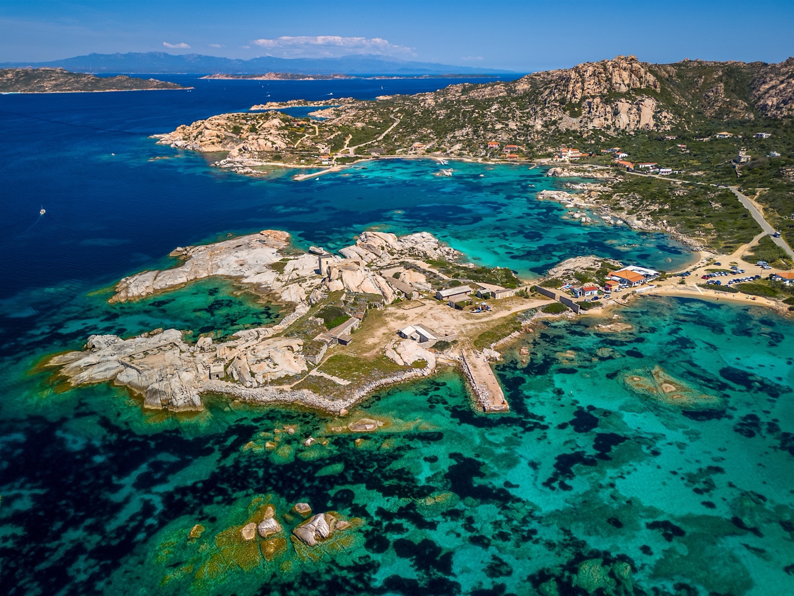
Caprera Walks and Hiking: Monte Tejalone, Cala Napoletana and the Park's Trails
Caprera is the best place in the La Maddalena archipelago to walk. The national park keeps a network of waymarked trails across the island, most of them short and rated easy, linking pine woods, granite ridges, old military forts and coves you would otherwise reach only by boat. The classic choices are the climb to Monte Tejalone, the island’s highest point, the path down to Cala Napoletana, and the coastal loop past Punta Crucitta to the Candeo fort. The one walk you cannot do on your own is the path to Cala Coticcio, which needs a licensed guide.
This guide sets out every trail the park describes, with its time, length and climb, then explains where to park, how the Cala Coticcio walk works, what to carry and when to go.
Caprera at a glance
- Caprera is joined to La Maddalena by a 600-metre bridge built in 1958, so you can drive, cycle or take the bus straight from town.
- Caprera’s wild eastern side made the island a nature reserve in 1982, later part of the national park.
- Western Caprera is flatter, with a large pine forest, while the east is steep granite falling to the sea.
- Stagnali, a former military village with a small marina, is the most populated part of Caprera.
- Garibaldi’s home, the Compendio Garibaldino, and the Memoriale in the Arbuticci fort are both here, so a walk combines easily with a museum visit. Our guide to La Maddalena town and Caprera covers the museums in full.
The park’s trail network
The park’s trail network on Caprera was built from 2011 to restore an old network of paths laid out for military use at the end of the 19th century. Those mule tracks once linked the batteries and lookouts that guarded the Strait of Bonifacio, which is why so many walks end at a fort or a ruined post with a view. Today there are 16 trails on Caprera.
What to expect on the ground:
- The park’s trails are marked with signposts and stone cairns. The cairns matter on bare granite, where the path is not always worn into the rock.
- Most trails are rated easy by the park, with climbs of around 100 m or less. Easy here means short, not flat: expect loose stones, granite steps and some steep sections.
- The park recommends its Caprera trails all year, from January to December. In practice, heat is the main limit in summer.
- Most of the northern trails start from the same place, the parking areas at the foot of the Arbuticci fort, so you can chain two short walks together.
The trails compared
| Trail | Start | Time | Length | Climb | Park rating |
|---|---|---|---|---|---|
| Monte Tejalone (trail 7) | Parking below the summit | 45 minutes | 1.5 km | 100 m | Easy |
| Poggio Stefano (trail 9) | Road to Arbuticci | 40 minutes | 1.2 km | 103 m | Easy |
| Poggio Zonza (trail 6) | Centre of the island | 55 minutes | 2.3 km | 65 m | Easy |
| Cala Portese (trail 4) | Cala Portese beach | 1 hour 15 minutes | 3.2 km | 40 m | Easy |
| Opera Candeo (trail 11) | Foot of Arbuticci | 1 hour 15 minutes | 3.3 km | 103 m | Easy |
| Punta Crucitta (trail 13) | Foot of Arbuticci | 1 hour 15 minutes | 4.5 km | 100 m | Easy |
| Cala Napoletana-Cala Crucitta (trail 14) | Foot of Arbuticci | 1 hour 15 minutes | 4.5 km | 100 m | Easy |
| Cala Caprarese (trail 15) | Foot of Arbuticci | 1 hour 30 minutes | 4 km | 100 m | Easy |
| Punta Crucitta-Candeo loop (trail 12) | Foot of Arbuticci | 1 hour 35 minutes | Loop | 100 m | Easy |
Times are the park’s own walking times. Add time for swims, photographs and the heat, and allow for the return leg where a trail is not a loop.
Monte Tejalone: the summit walk
If you do only one walk on Caprera, make it this one. Monte Tejalone (trail 7) is the highest summit of Caprera’s ridge; the path starts off the paved road to the Arbuticci fort, from a small parking area.
- The Monte Tejalone trail takes about 45 minutes and is rated easy.
- The Monte Tejalone trail is 1.5 km long with 100 m of climb.
- The Tejalone path starts with a steep climb under a dense holm oak wood, a rare survivor of the island’s original woodland. It is the shadiest start of any walk on the island, welcome on a hot morning.
- In autumn and winter the holm oak wood fills with boletes and other colourful fungi, not all of them edible. Look, photograph, and leave them where they are: this is a national park.
From the top, the whole archipelago spreads around you: La Maddalena town to the west, the outer islands to the north and the Sardinian coast to the south. It is the best viewpoint on Caprera for understanding how the islands fit together before a boat trip.
Poggio Stefano and Poggio Zonza: two short climbs
Poggio Stefano
Trail 9 climbs Poggio Stefano, the second summit of Caprera’s ridge: 1.2 km, 103 m of climb, about 40 minutes. It is short but steeper than Tejalone for its length. There is no parking at the start of the Poggio Stefano trail; park at the foot of the Arbuticci fort or of Monte Tejalone. With a car parked at Tejalone, the two summits make a satisfying morning.
Poggio Zonza
Trail 6 to Poggio Zonza is 2.3 km with 65 m of climb and takes about 55 minutes. This is the walk for history. Poggio Zonza passes the ruined ‘old Corsican houses’ of shepherds from Corsica, Caprera’s first near-permanent residents from the end of the 1600s. Little remains beyond low walls among the granite, but it shows how people lived on the island long before Garibaldi bought his land here.
Cala Napoletana: the walk to a swimming cove
Cala Napoletana is one of the loveliest coves on Caprera, and one of the few you can walk to without a guide.
- Cala Napoletana is reached by sea or on a path from the Arbuticci battery past a ruined lookout over the Strait of Bonifacio. From the lookout you see the northern islands, Budelli, Razzoli and Santa Maria.
- Trail 14, Cala Napoletana-Cala Crucitta, takes 1 hour 15 minutes and is 4.5 km long with 100 m of climb.
- The park says this route best sums up Caprera’s scenery, nature and history.
- Cala Napoletana is three small beaches; its shallow, gently sloping sandy seabed is perfect for snorkelling. Pack a mask.
- The middle of the day is best for its colours, which is also the hottest time to be on the path. Walk down in the morning, swim, and come back up once the worst heat has passed.
Remember that boats anchor off the cove in summer, so you will rarely have it to yourself in July and August. Our guide to snorkelling and diving at La Maddalena covers what you will see under the water.
Punta Crucitta and the Candeo fort
The north coast of Caprera holds the park’s most rewarding walk.
- Trail 12, the loop from the Arbuticci fort to the Candeo fort via Punta Crucitta, takes 1 hour 35 minutes and is rated easy.
- The Punta Crucitta-Candeo loop has 100 m of climb.
- The park calls this loop along most of Caprera’s north coast the most significant walk in the park for history, nature and scenery.
If you want a shorter version, two trails cover parts of it:
- Trail 13 to Punta Crucitta and its cove takes 1 hour 15 minutes, is 4.5 km long with 100 m of climb, and starts at the foot of the Arbuticci fort.
- Trail 11 to the Opera Candeo is an easy walk of 1 hour 15 minutes. The Opera Candeo trail is 3.3 km long with 103 m of climb. The Candeo fort was an anti-ship battery built in the early 20th century and manned by the navy in the Second World War; you park at the foot of the Arbuticci fort.
Cala Caprarese and Cala Portese
Cala Caprarese
Trail 15 to Cala Caprarese is 4 km with 100 m of climb and takes 1 hour 30 minutes. It starts from the crossroads at the foot of the Arbuticci fort, down the fire track towards Cala Garibaldi, and crosses pine woods thinned by fire at the end of the 1980s. The open ground means little shade, so this is one for a cooler day.
Cala Portese
The easiest walk to reach without a car starts on a beach. Trail 4 at Cala Portese is an easy loop of 1 hour 15 minutes. The Cala Portese trail is 3.2 km long with 40 m of climb. It starts from the wide white beach of Cala Portese, also known as ‘I due mari’, in the south-east of Caprera, easy to reach by car, bike or bus. Cala Portese offers boats a sheltered landing on mistral days, so the bay can be busy with anchored boats even when the rest of the coast is rough.
Combine it with a swim at the beach and the short drive or walk on to the Spiaggia del Relitto, described in our guide to the beaches you can reach by car.
Cala Coticcio: the guided-only walk
The most famous cove on Caprera is also the most protected. Cala Coticcio and Cala Brigantina on Caprera lie in highly protected zones and can be reached on foot only with a licensed environmental hiking guide. The TA zones of Cala Brigantina and Cala Coticcio are areas of significant natural interest that need high protection, so they cannot be walked freely.
How it works:
- Book a walk with a guide. The park publishes a list of guides. The guides for Cala Coticcio and Cala Brigantina are private operators, not park staff, and you agree the price with them.
- Pay the park’s contribution. Each visitor also pays a €3.00 environmental contribution to the park (children up to 12 are exempt), separate from the guide’s fee and not refunded if the walk is cancelled. Payments to the park can be made only through the national PagoPA platform.
- Mind the date. The €3 park ticket is valid only for the day stated and cannot be refunded if unused.
- Carry proof. Keep a copy of the payment to show the park’s control staff before the walk.
What the walk is like: the walk to Cala Coticcio is tiring and needs trainers and plenty of water; the last part is rather steep. The reward is worth it. Cala Coticcio is a natural pool, full of fish and starfish, ideal for snorkelling.
If a guided walk does not suit you, the cove is also seen from the water: the full-day boat trip from Palau includes the clear water of Cala Coticcio among its stops.
Forts, batteries and lookouts
Many of Caprera’s paths exist because of the military. Batteries facing the sea include Nido d’Aquila and Punta Tegge in the south-west of La Maddalena and Punta Rossa on Caprera. Old anti-aircraft posts at sites such as Candeo and Teialone can be visited with the park guides.
The Arbuticci fort at the hub of the trail network now holds the Memoriale Giuseppe Garibaldi. From 26 October 2026 the Memoriale opens only in the morning, 8:30–13:45, last entry 13:00, so in winter plan a walk for the afternoon and the museum for the morning.
Where to park and how to get there
- By car or scooter. Cross the bridge from La Maddalena and follow the paved road up through the pines. The parking areas below the Arbuticci fort serve most trails; Monte Tejalone has its own small parking area.
- By bus. Cala Portese is served by bus from town, which makes trail 4 the easiest walk without your own transport.
- By bike. The climb from the bridge to Arbuticci is long and steady; it is a good ride in spring and autumn and a hard one in August.
- From the ferry. Ferries link La Maddalena with Palau, 40 km from Olbia, so a day of walking on Caprera works even from the Sardinian coast if you bring a car or a bike across. See getting to La Maddalena for the ferry.
When to walk
The park keeps its trails open all year, and spring, autumn and the milder winter days are the best time to walk on Caprera. The granite reflects the heat and the pines give only patchy shade, so a summer walk should start early. Our best time to visit La Maddalena guide sets out the climate month by month, and the weather page on this site has the five-day forecast.
- Spring: flowering scrub, mild temperatures and empty paths.
- Summer: walk at first light, carry more water than you think, and finish with a swim.
- Autumn: warm sea, cooler air and, on Tejalone, the fungi in the holm oak wood.
- Winter: clear views on calm days; check museum hours if you are combining a walk with the Memoriale.
What to wear and carry
- Shoes with grip. Trainers or light walking shoes; granite is slippery when dusty and the paths are stony.
- Water. There are no fountains on the trails. Carry at least a litre per person for the short walks, more for Cala Napoletana.
- Sun protection. Hat, sunscreen and a long-sleeved top for exposed routes such as Cala Caprarese.
- Swim kit and a mask for Cala Napoletana, Cala Caprarese and Cala Portese.
- Downloaded map. Phone signal can be patchy below the ridges; the park’s cairns and signposts mark the way, but a map helps on junctions.
Rules on the trails
- Stay on the marked paths: Caprera is a protected island, and the TA zones around Cala Coticcio and Cala Brigantina carry fines for walking without a guide.
- Taking sand, shells or other natural materials is forbidden, as it is everywhere in the park.
- Fires and camping are not part of a park visit; take your rubbish back with you.
- Keep dogs on a lead near wildlife; Caprera has a population of wild goats of unknown origin, genetically distinct from Sardinian goats, and you may well meet them on the ridges.
Caprera on foot with children
Children who walk regularly will manage Monte Tejalone, Poggio Stefano and the Cala Portese loop without trouble. Cala Napoletana is a fine target for older children because of the swim at the end, but the walk back up is tiring in the heat. For younger children, the beaches you can drive to, such as Cala Portese, are easier, and the Compendio makes a good shaded break. Remember that children up to 12 do not pay the park’s contribution for the Cala Coticcio walk, though the guide may set an age limit of their own.
A day on Caprera
- Morning: drive or ride to the Monte Tejalone parking area and climb to the summit before the heat.
- Late morning: walk the Cala Napoletana trail from Arbuticci and swim.
- Afternoon: visit Garibaldi’s home at the Compendio (booking is strongly recommended), then the Memoriale if it is open.
- Evening: a last swim at Cala Portese before heading back over the bridge to town.
A walk on Caprera pairs naturally with a day on the water: see the islands from the summit, then join a boat trip into the archipelago to swim at the coves you looked down on.
Frequently asked questions
How hard are the walks on Caprera?
The park rates all the trails described here as easy, with climbs of about 100 m or less and times between 40 minutes and 1 hour 35 minutes. The paths are stony, though, and the heat is the real difficulty in summer.
What is the highest point on Caprera?
Monte Tejalone, the highest summit of Caprera’s ridge. Its trail is 1.5 km long and takes about 45 minutes.
Can I walk to Cala Coticcio on my own?
No. Cala Coticcio lies in a highly protected zone and can be reached on foot only with a licensed environmental hiking guide, plus the park’s €3 contribution.
Where do the trails start?
Most start from the parking areas at the foot of the Arbuticci fort; Monte Tejalone and Cala Portese have their own starting points.